Sunday, October 23, 2022

Watkins Glen Getaway

(Virginia at our Catharine Cottage)

Ever since the slogan "Ithaca is Gorges," was a popular bumper sticker, I had wanted to explore the Finger Lakes region of New York State.  There are lots of gorges in the Finger Lakes, and Ithaca has its share, but Watkins Glen, billed as one of the most stunning places in the State of New York and one of the most popular state parks in the United States, sounded intriguing.

When my friend, Karen, and I discovered that we both had been wishing to visit the area, while our husbands were fairly disinterested, we teamed up in March and made lodging reservations for mid-September.


(Catharine Creek in front of our cottage)

Camping is Karen's and my usual MO for overnights but we decided to pamper ourselves with "real" accommodations this time.  Looking online, I found Catharine's Cottages just south of Watkins Glen on Catherine Creek in Montour Falls.  

At the same time, Karen discovered that the cottages were next to the Catharine Valley Rail Trail, a perfect 13-mile bike ride for us.  And so we took off with our bikes and hiking boots, leaving the tent and husbands behind.


Immediately upon arrival in the late afternoon, we checked into our cottage and, with rain in the forecast, had a quick snack, hopped on our bikes and headed for the Catharine Valley Rail Trail and into the village of Montour Falls.


(Karen on the Catharine Valley Rail Trail)


The crushed stone trail was picturesque between lush green forest.  When it opened onto the streets of Montour Falls, we were unsure which direction to choose to see the two waterfalls we had read as being within the village itself.  A policeman, noticing our dilemma, pointed to our left for one and to the right towards the second on the edge of town.  He also suggested perusing the historic section of town.


(Shequaga Falls in the village of Montour Falls)
 
Shequaga Falls was literally around the corner.  A sidewalk between two historic houses led to a small park with a direct view of the falls.  While the waterfall was beautiful, I wondered about the wisdom of building so close to this much powerful water.  Yet, these houses had been here for nearly 200 years.
 
We were attracted to an 1840 house with its meticulously maintained property, multiple additions tucked beneath old trees, and a stone's throw from the falls.


(charming 1840 house)
(note the waterfall just behind the house and a few trees)


We continued on to Aunt Sarah's Falls a mile farther north and on a busier road.  This waterfall was less dramatic and in a less picturesque location.  
 
Back on the bike trail, we hoped to ride the few remaining miles to the town of Watkins Glen, but thunder not far away and a darkening cloud cover forced us to turn around.  We returned through the historic neighborhood but didn't linger as more thunder rumbled.  Cruising into our cottage's driveway and lifting our bikes onto the protective porch, we were glad to be indoors just as rain arrived in earnest.


(fascinating rock carved by Glen Creek at Watkins Glen State Park)

It rained all night and continued into the morning.  Even as we pulled into Watkins Glen State Park, rain pounded the car's roof.  Fortunately, as predicted, it let up shortly after we went through the park's gate.

Karen and I loved walking the 1.5 mile Gorge Trail with its 19 waterfalls.  I was also taken with the serpentine rock formed over thousands of years by the rushing water.  


(Virginia behind the waterfall)

In addition, man-made rock work was spectacular.  The Civilian Conservation Corps, a back-to-work program as part of Roosevelt's New Deal, constructed trails and stone work in over 800 parks in its 9-year existence.  Although very familiar with the CCC's work at home and elsewhere, we wondered how men survived the dangerous trail and bridge construction next to or above tumultuous waterfalls and the roiling river.   


(Rainbow Falls)


Rainbow Falls has it all: a delicate waterfall that sprinkles the tourist who walks beneath; the fast billowing Glen Creek; a flight of stone steps that rise to a stone bridge; and the water-carved limestone and shale sedimentary rock formed over 10,000 years.  Rainbow Falls' beauty has made it the most photographed waterfall in the park.


(Central Cascade)


At 60 feet high, the Central Cascade is the tallest waterfall in the park.  Might the bridge builders here have been afraid they might slip and tumble?  Every turn in the path held new fascination for us.

And what about those 832 steps throughout the gorge?  As veteran hikers, Karen and I had no trouble climbing them. We had brought our hiking poles, since we were new to the park and hadn't known what to expect, but we did not need them.  


(Karen on a grand flight of stairs)


We ended our stair climb at Jacob's Ladder, which alone is comprised of 180 steps.  At the top, we took the Indian Trail, making a loop return to where we had begun.  After watching our steps on rocks and stairs in the gorge, it felt good to stride right along on this pretty trail.

And just as we made our final ascent to the parking lot, the sun came out in earnest.


(Iconic view at Watkins Glen marina on Seneca Lake)

Once out of the park, it didn't take us long to decide to stop at Captain Bill's and get tickets for a 50-minute boat ride on Seneca Lake.  The water sparkled under the sunny blue sky as we boarded the Seneca Legacy.

The lake has a long human history from the Seneca Indigenous Nation to today.  We saw a mix of historic periods from the boat.  Earliest was the diagonal line on these horizontal cliffs.  This Native American path provided an escape route from Seneca Lake in times of danger as well as access to the lake for fishing and water travel.  
 

(a diagonal line on the cliff is a path made by Native Americans)
 
Later came the steamships from the 1830s to the 1920s, zigzagging back and forth across the water for business, shopping, visiting, and tourism.

 
(the last remaining steamship dock)

I was surprised to see salt mines in two locations on the lake near the town and was a bit unnerved by the smokestacks at both ends of the waterfront.  I was reminded of the Greenidge Plant on the north end of Seneca Lake.  Once an environmentally dirty coal-burning plant, Greenidge now burns fracked gas for cryptocurrency mining sparking new environmental battles.

We also saw plenty of beauty.  Hector Falls tumbles directly into the lake and iconic farmland dots the shoreline.  We had a perfect afternoon to enjoy being on the water.


Back at our little cottage, our thoughts turned to dinner.  With some research and a few phone calls, we chose Horseheads Brewing in Watkins Glen where we had a delicious meal by the marina with views of the lake.
 
The next day we took the advice of our friend, Trisha, who had recommended a drive through Amish and Mennonite farmland on the west side of Seneca Lake.  What a great suggestion!


We toured beautiful countryside, taking short jaunts on back roads to get deeper into the landscape.  Occasionally, we saw an Amish buggy or passed a schoolhouse with bicycles parked alongside.

 
We stopped at this lush Mennonite farm stand with its bounty of mum plants.  Once inside, the overwhelming aroma of grapes greeted us.  This is wine country after all! 

Boxes, barrels and shelves overflowed with produce from the early fall harvest.  Bins of tomatoes and peaches had us imagining Mennonite or Amish wives canning food for winter in their large kitchens, not to mention sauce simmering for dinner or a fruit pie warm out of the oven.


Having brought our bikes along for the drive up the west side of Seneca Lake on the recommendation of a woman at the Watkins Glen Visitor Center, we continued north.  She had suggested that we bicycle the Keuka Outlet Trail from Penn Yan to Dresden.  This 6-mile path runs between Keuka Lake and Seneca Lake.


Although the rail trail began as a beautiful stone dust ride through woodland and along the "outlet," it quickly deteriorated, at times just a foot-wide dirt track, other times rubbly.  Twice we had to lift our bicycles over large fallen trees. 
 
Despite the trail's poor condition, we wanted to see its highlights: Seneca Mill Falls and Cascade Mill Falls.  As soon as early settlers saw the potential for hydropower available here, industry grew.  Ruins of the Seneca Paper Mill offer a glimpse of the past.
 
The trail ended in Dresden where we turned around and headed back to my car in Penn Yan.
 

True to character, Karen had researched ice cream locations and found Penn Yan's Seneca Farms.  Seneca Farms' homemade ice cream with their own hot fudge made a tasty ending to our Finger Lakes adventure.


Sunday, August 15, 2021

A Visit to Churchtown Dairy

(The Round Barn and Cow Barn behind a plethora of coneflowers)

I had never heard of the Churchtown Dairy before my sister gave Bill and me a Christmas gift certificate for the shop there.  We checked out the website and chose August as a good time to visit the Dairy, when the farm would be lush and productive.   According to the website events calendar, tours are only on Saturdays. We definitely wanted to go on a tour.  Last week, our calendar and the Dairy's calendar fit together perfectly.

The drive to Churchtown, just a few miles from the City of Hudson, was just under an hour. We arrived early at the farm which gave us ample time to wander through the gardens and to peruse the farm store before the tour began.  


(Flowers provide colorful accents throughout the property)

In the 1980s, as farmland in Columbia County became a high commodity for development, Peggy Rockefeller (wife of David Rockefeller) purchased more than 3000 acres of farmland as it came on the market, saving many farms in the Hudson Valley.  Two-hundred-fifty of those acres became the Churchtown Dairy.

Peggy and David's daughter, Abby, had a vision for the 250-acre parcel.  In 2008, she began sharing her dream for a dairy farm with builder, Rick Andersen, giving him one command, "it has to be beautiful." It took four years to complete the drawings for the project, but by 2014 the buildings and dairy were operational.


(The garden is crowded with many varieties of plants)

The flower garden that I had admired upon arrival was constructed a little later, in 2017.  Tours specific to the garden are on Wednesdays, when the gardener, Jean-David Derreumaux, explains the healing qualities of the plants and aspects of biodynamic gardening.  

Biodynamic gardens are created in harmony and beauty with the land and nature, abiding by such methods as planting and harvesting with the cycles of the moon.  This colorful and aromatic garden with its water feature, benches, and a gazebo tucked behind climbing plants, seemed the perfect place to escape from the pressures and stresses of today's world.  

I asked the guide if people request to have their weddings here.  She said, "They may, but we don't host weddings."  And, I thought, there isn't the financial need to do so.


(Swallowtail butterflies love the garden too.)

Thirty primarily Brown Swiss cows graze the Dairy fields, rotating from one field to another daily.  Ongoing rotations do not exhaust the soil which then can continually regenerate, a feature of a biodynamic farm model. Churchtown Dairy also raises about 30 grass-fed beef cows in a separate field.

Our guide wanted us to understand that, while most cows have their horns removed while young, the cows here do not.  Their horns pose no safety concerns for the farmers, since the small number of cows have plenty of space to roam.  She also explained how the cows use their horns. Sometimes one will affectionately stroke the head of another with a horn.  She described a cow who used her horn to move an object that was in the way.  Keeping the cows relaxed and happy are all elements of maintaining a respectful farm family.


(A farm worker brings the cows in for milking)

We walked away from the garden toward the Round Shaker-style barn and the cow barn.  I was astonished that these buildings, that appear as if easily 100 years old, were only constructed in the last 7 or 8 years.  With slate roofs, pristine white paint, and charming dormers and cupolas, how could anyone afford to build such a farm?  Our tour guide reminded us that this was not just a farm; this was a Rockefeller Trust Property.  The builder had ample funds to "make it beautiful."


(the "ramp" leads into the upper level of the barn)

The Round Barn is an object of beauty and practicality.  In the winter, when snow covers the grassy fields, the cows come here to eat.   As a bank barn, in this case with a man-made hill to the second level, both the upper and the lower floors can be accessed from ground level.  

Hay baled in the traditional rectangular cuboid shape is loaded into the barn's upper level.  When the cows come into the lower level through another entry, the bales are easily dropped to the barn floor, then loosened and spread onto the floor's outer circle where the cows await.


(the second level with stored hay bales, and the roof)

Outside of the building, I had admired the pointed design on the roof.  When I came inside with the tour group, I was stunned by the magnificent star motif at the roof's pinnacle.  Warm natural wood comes together in a design that creates art out of the practical need for a ventilation system in the barn's ceiling. 


A milking barn, attached to the Round Barn, was reconstructed from an 1850s barn in New Hampshire.  In temperate seasons, the cows spend almost all the hours of the day outdoors, coming in only to be milked morning and evening.  For these two brief periods, they eat hay and a small amount of grain.  When the milking is finished, they go back outdoors where they consume fresh grass in the fields day and night. 


(Most of the cows here are Brown Swiss)

Generally, the calves are born in the field. Despite the common thought that a large number of births require human or veterinary intervention, this is rarely the case.  If a cow doesn't return to the barn in the morning, a farmer walks into the fields to see that all is well.  After a day or so, the cow will come to the barn, with her calf alongside, and rejoin the others.  

There is no rush to separate calves from their mothers, unlike at most modern farms where calves are moved to the calf pen within 24 hours of birth.  At the Churchtown Dairy, mothers and calves stay together for a few weeks and reunite regularly once the calf moves to the calf pen, another aspect of biodynamic farming that promotes happier and healthier animals.

As our tour ended, a few families arrived to watch the milking.  What a great educational opportunity for children!


(view through the milking barn to the field)

Raw milk is an important product of the Dairy.  Legal certification to be a raw milk producer requires maintaining a rigorous sanitation and hygiene program, along with weekly testing for pathogens.  In addition, the milk goes directly from the cow into containers, rather than through tubes and systems to a milk tank.  This avoids the excess use of cleaning chemicals.

In the store, I asked if people came from miles around for the raw milk.  "Yes, they do," she said. "Even if they have farms that produce raw milk closer to their homes, they often prefer our milk because it has passed the meticulous certification process."


(raw milk on the left; frozen beef on the right)

Bill and I contemplated how we would use the gift certificate my sister had given us. 

Besides milk, beef, and medicinal or luxury products made from the flowers, cheese is a reason to shop here.  A fresh creamy cheese, two types of Camembert, and a semi-hard cheese are cave-aged at the farm and are very popular.  The shop also sells books and gift items, some made by local craftspeople.  In the end, we brought home two cheeses and a "supernatural washable paper insulated lunch bag."


It was dinner time when we left the Churchtown Dairy and we were hungry.  One option, if we had thought ahead, would have been to bring a picnic.  Another is to visit nearby Hudson with its many shops and restaurants.  Or you may do as we did, and stop at a familiar restaurant on the ride home.

Thursday, June 24, 2021

Hiking in the AMR, 2021

(Summit view from Dial Mountain)

I was curious about the new Adirondack Mountain Reserve (AMR) pilot parking reservation system and decided that I would try it out for my annual solo hiking retreat.   I chose to be away the nights of June 15 and 16, and reserved a campsite at Heart Lake, part of the Adirondack Mountain Club's property within the High Peaks Wilderness area.  Next, I would reserve a parking spot in the AMR lot.

 
(Weather was a bit ominous upon my arrival at the Heart Lake Campground)

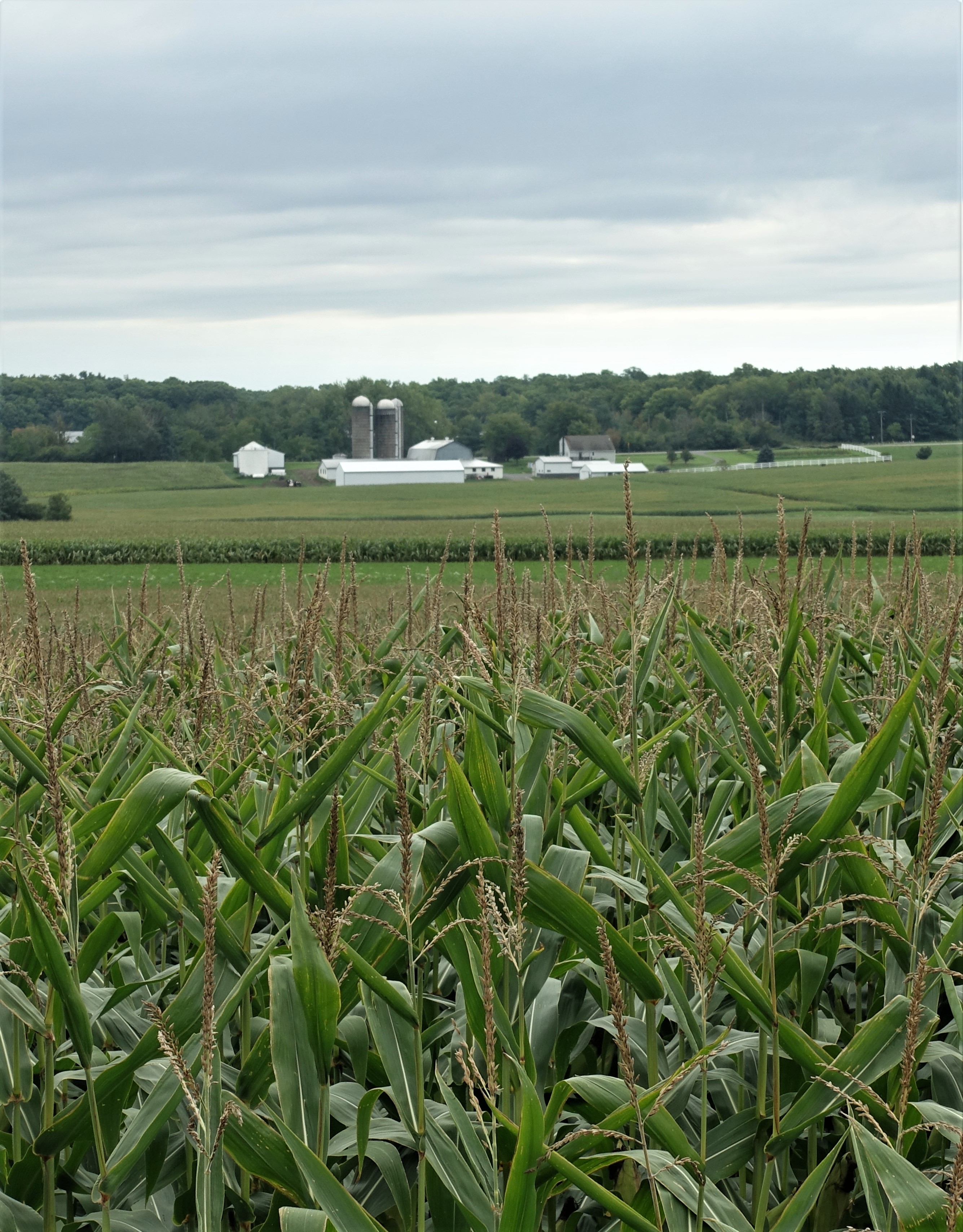
The Adirondack Mountain Reserve is 7000 acres of privately owned land nestled among high peaks and lakes in St. Huberts, New York.   The land includes the elite Ausable Club.  In 1973, New York State and the Ausable Club worked out conservation and foot traffic easements on some of the club’s land.  

In 2020, an unprecedented number of people chose to be outdoors in the Adirondacks.  Overuse and parking issues became a hot topic.  Often bandied about was the controversial idea of a permit system for parking and hiking.  As a private entity, the AMR had the ability to join the New York State Department of Environmental Conservation in working out a 2021 pilot parking reservation system solely for the AMR lands.


(A young hardwood forest near the Noonmark Shoulder, perhaps new growth since the fire of 1999)

I wondered if I would like registering for a parking permit on a specific day and for a particular time slot for hiking.  When my daughter, Meredith, and I were hiking the 46 High Peaks of the Adirondacks, we often changed our plans based on weather or other factors.  A permit system would make spontaneity out of the question.

Still, I jumped right in.  On the requisite day, two weeks in advance of my camping days, I went on the AMR website and reserved parking and hiking time slots for the two consecutive days that I would be camping.  In the intervening weeks before my trip, I mulled over which trails I hoped to go on, now that I was technically through the gate.


(The Noonmark Shoulder whets the appetite to continue up Dial, at left)

Immediately before my departure days, the weather forecast predicted 100% rain for part of June 15.  I decided that I would skip hiking that day and drive up to my campsite in the afternoon. Before I left home, I cancelled my parking reservation for the 15th.  My cancellation went through instantly and I was able able to book the 17th as my second hiking day just moments later.  I was pleased with this efficiency.

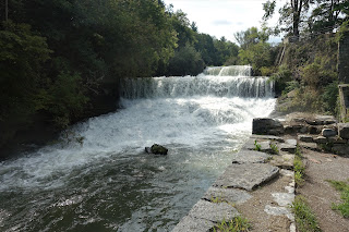
True to the forecast, it started to pour within 30 miles of my destination.  As I pulled into the campground, the tumult lessened to a drizzle and I quickly set up my tent.  Then I took my salad-with-chicken dinner and folding chair to the lake before the rain settled in again.  The air was chilly and windy, and clouds hung heavy on Street and Nye Mountains across the lake.  No question, though, it felt great to be there.


(The summit view from Dial Mtn.)

There is nothing quite like being cocooned and dry in a small tent with my sleeping pad and bag laid out, my battery light and book ready for some evening reading, while the rain pounds on all sides.  When I got tired of reading, I listened to the rain and to music on my iPod. 

Later, I awoke to silence and stepped outside.  I could see brilliant stars through the trees above and decided to walk a few feet to a clearing.  The milky way crossed the black sky in glittering lights.  The next day would be perfect for hiking.


(I had been hoping to see lady's slippers on this hike, but did enjoy coming upon a lush community of bunchberry)

The night temperature had gone down into the low 40s. Daytime highs would rise to a comfortable 65.   After my yogurt and granola breakfast, I drove the half-hour to the AMR in time for my choice of an 8:30 a.m. slot.  A cheerful young man checked me in and instructed me to park between chalk lines.  How leisurely to arrive at the relatively late hour of 8:30 and not have to worry about a parking spot!


Of the many options, I had decided that on this, my only full day, I would hike to the Noonmark Shoulder of Dial Mountain.  From there,  I would decide whether to continue on to Dial's summit, the 41st of the 46 Adirondack High Peaks. 

In 1999, a forest fire burned 90 acres of the Shoulder's forested ledges clearing the terrain to bare rock.  Hikers have since been treated to an impressive view. 

Alone on the rocks, I had a snack and a short rest.  I checked my watch.  Only 10:30 -- why not continue on to Dial's summit?


(Heart Lake on a cool clear evening)


High peaks are difficult hikes, both going up and coming down, but the rewards are great.  Dial is not one of the most difficult but it's still challenging and a hefty workout.  Whenever I hike a peak by myself, I feel slow and plodding, yet I am always within my expected time frame.  When Meredith and I hiked them together, we commiserated about the tough parts and she sometimes sang songs along the way like the Allman Brothers', "Everybody's Got a Mountain to Climb."  

These days, I hike a couple of high peaks a year because the views are unparalleled in New York State, I love being up high, and because I like knowing that I can still do them.  If I can hike high peaks, I am pretty sure I can hike just about any mountain that I am likely to come upon during the year.  I like heading out and feeling competent.


(I was still hoping to see lady's slippers, but this princess pine was very pretty)


From the rocky top of Dial, I could see many familiar mountains with their slides, humps and hollows. After I had soaked in the view long enough to carry it in my mind's-eye, I turned and headed back the way I had come.  

The hike from the AMR parking lot to Dial's summit and back is 10 miles, with 3000 feet of elevation gain.  I saw only three people on the trail all day.


(A very nice view of Giant Mtn. from Round Mtn.)


Evening light was stunning on Heart Lake when I walked from my campsite to the dock to soak my feet in the lake's cold water. I had picked up a take-out meal from the Ausable Inn in Keene Valley for my post-hike dinner and spread it out next to me on the dock while minnows nibbled my toes.

A loon swam alone in the distance and then in a great splashing ran across the top of the water flapping its wings hard as if it could not take off...until it rose above the lake.  It flew four times around the small lake.  As it passed overhead, I could hear the loon's wings propelling its flight until it took off over the trees and out of sight.  


(Relaxing with Giant behind me)


The next morning, I packed up my campsite, since I would drive home after this day's hike, and ate my breakfast quickly in order to get to the AMR parking lot by 8:30.  I would hike the loop trail to Round Mountain. This hike is 5 miles round-trip with 1800 feet of elevation gain -- a great half-day option. Round Mountain was new to me and I was excited to start out on this spectacular cool clear day.


(A portion of the grand view from Round Mtn.)

I had read that Round featured an excellent view of Giant Mountain. After a steady uphill climb, I was ready for a sit-down when I reached the outlook framed by deep green spruce trees. I sat on a rock surrounded by soft moss and ate my snack. 

I continued on a hemlock needle path for a short distance when the trees opened to a large outcropping and an immense view from the Champlain Valley in the east to Whiteface Mountain in the northwest.  Nothing I had read prepared me for such a magnificent scene!


(Looking towards the Champlain Valley and Vermont)

I didn't stay too long at this summit, but checked out the panorama from every ledge, and then began my descent.  I was almost to the end of the hike when I decided to take a break.  After poking around in the open woodland a minute, I found a fallen birch log to sit on.

I fished in my backpack and pulled out the mango that I had been carrying all day.  It would have been a good idea to cut up the mango before I began the hike and put it in a container, but I hadn't wanted to bother to take the time to do that.  With my father's Opinel knife, I peeled it, cut off sections, and ate the sweet juicy fruit with my fingers -- an exotic treat here in the northwoods.  After I collected the peels and pit and stowed them in a sandwich bag back in my pack, I rinsed my hands in a tiny stream that trickled between the rocks.


(A perfect spot to take a rest and enjoy the forest...and a mango)


I had met only four people all day.  

As I reached the end of the trail, I saw the young parking lot attendant coming down the road.  We walked the last quarter-mile together.  He told me that the response to the AMR parking reservation system had been positive.  "I only get about one person a week who is angry about it,"  he said.  Given that the lot holds 70 cars, which would be 490 cars in a week, each car generally carrying a few people, I guess one grouchy hiker isn't too bad.  I gave him a very positive report.  You just have to think ahead, be a little flexible, and book a couple of days in case of bad weather.