Showing posts with label hiking. Show all posts

Sunday, February 14, 2021

My Windham High Peak Covid Challenge


Virginia, February 2021


The idea of hiking Windham High Peak in the northern Catskills every month of the year was not my initial intention. In early March 2020, I had scheduled an Adirondack Mountain Club (ADK) hike to the Tongue Mountain Range overlooking Lake George in the Adirondacks.  I was excited to have a full group of 12 participants but, as the date approached, news of the Coronavirus reaching the United States, then the east coast, and eventually New York City suddenly raised concern.

Carpooling no longer seemed safe. Participants began emailing me that they planned to drive alone to the trailhead.  When I remembered that the parking area for the Tongue Mountain hike would only hold about five vehicles, I realized that I needed to come up with a different location.


The Three Jims socially distanced, March 2020

The large parking lot at Windham High Peak fit the bill.  In addition, this mountain is not far from the Albany area and seemed an environmentally conscious option if each car would only include the driver. I knew that many of my participants would decide not to join in such a dramatic change of plans and was not surprised that, of my original group of twelve, just three chose to attend the revised hike.


Spring Beauties, May 2020
 

Jim C., Jim G., and Jim O., all men with whom I had hiked many times, were enthusiastic about the new plan. The four of us enjoyed the trail, the camaraderie and the views.  We agreed that Windham High Peak had been an excellent alternate hike on a beautiful late-winter day.


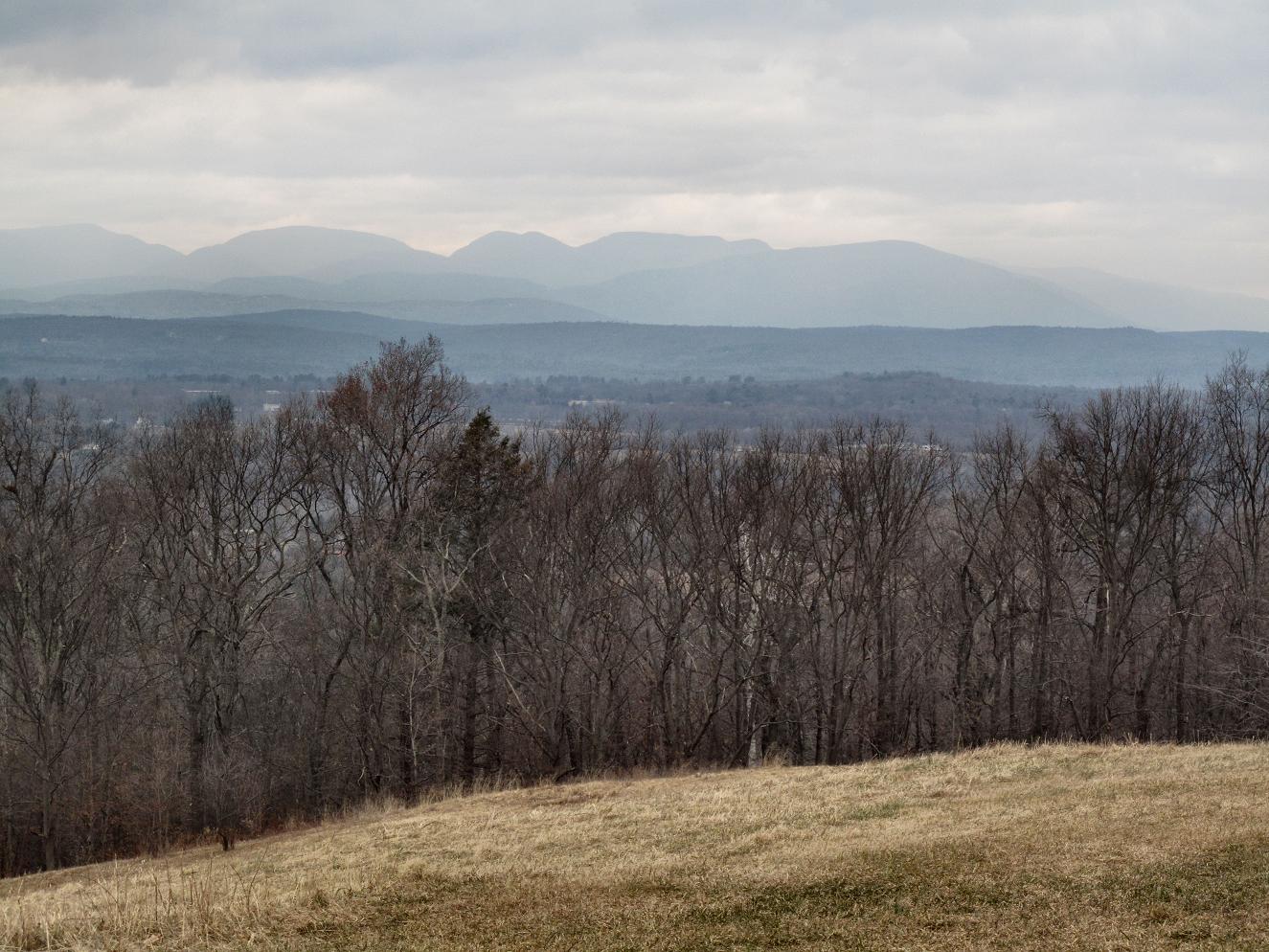
Looking east towards Albany, June 2020


Lush forest green, June 2020

By April, the Governor encouraged people to stay close to home, which, for me, did not include the Adirondacks.  I returned to Windham High Peak because I wanted to hike, knew it had a pretty trail and nice views, and because I wanted to stay in shape for an eventual return to the Adirondacks.  

This time I hiked by myself, the safest choice given the spread of the virus. I saw no one on my way up the mountain, but, on my descent, I passed a few small groups making their ascent.  I put on my mask and stepped off the trail to let others go by.  Most of the other hikers did the same.


Mountain Ash, July 2020

Stinging Nettles, July 2020

Warm, sultry, and no view, July 2020


By June, now my 4th consecutive month on Windham High Peak, I came up with the idea of repeating this hike every month of the year from March 2020 through to February 2021.  I dubbed this My Windham High Peak Covid Challenge.  I looked forward to watching the seasons change in this particular location. Not only that, the drive from my home was very pleasant as it meandered through beautiful familiar countryside. 


Sue, August 2020


July came and I fought with the weather.  Summer, with its heat and humidity, is not my time of year.  And there were other annoyances. Where spring beauties had lined the path in May, stinging nettles became a plague in July.  I had focused on the presence of ticks but hadn't given nettles a thought when I wore shorts and carefully covered my bare legs with tick spray.  My skin was virgin flesh for the nettles.

The sting of stinging nettles lasts 20 or 30 minutes at the most, in my experience, just long enough to be annoying on a warm day during the hike's ascent and back on the descent.  In addition, the view was completely socked in and I was getting bored.  I decided that I would ask a friend to join me in August, reasoning that two of us driving in two cars and staying socially distant would be safe from the virus and not too environmentally negligent.


My favorite hiking companion, daughter Meredith, September 2020


South-facing view of Blackhead Range, September 2020


I delayed my August hike long enough to find a cool day.  Barely squeaking the trip in, one of my ADK friends, Sue, joined me on the 31st.  Sharing the adventure felt great. To top off the day, as we descended, we saw two other ADK friends heading up. We put our masks on and stopped for a short visit.  


Deb, October 2020

Looking north, mixed autumn color, October 2020


Windham High Peak boasts three summit overlooks.  The south-facing view faces the Blackhead Range of the Northern Catskills.  Another rocky outcropping offers a north-facing scene across hills and a valley of farms and small towns to the Adirondacks in the distance.  Finally, continuing on the summit trail and after a slight descent, the Hudson Valley and Empire State Plaza in downtown Albany are visible on a clear day to the east.  Any of these is a perfect location for a lunch stop.


Trisha, November 2020


My daughter, Meredith, came up from New Jersey for my September hike.  At the mountain summit, her Garman Watch told us that we had hiked the equivalent of 81 flights of stairs!

In October, my friend, Deb, displayed the resilience of the lifelong athlete that she is by hiking with me not long after her meniscus surgery.  Trisha, one of the women with whom I camp in the Adirondacks, joined me in November.  Karen ended 2020 with me in December and brought Dove chocolates to share...just to keep us going, of course! Having someone with me was fun and just the change I needed.


Karen, December 2020

Other friends asked if they could accompany me as I began to close in on my year-long challenge, but the virus raged into a double-digit infection rate. I chose to hike alone in January. I basked in the quiet and solitude of winter, saw only three other hikers, and felt far away from the stress and anxiety of life in the valley.

I was thrilled to see a distant cloud inversion or "undercast."  Although many people I knew had witnessed far more dramatic undercasts this season while hiking in the Adirondacks and in New Hampshire's White Mountains, I felt fortunate to see one just before the clouds rose and covered the distant mountains. 


Beautiful snow, southern view, January 2021

The "bones" of the terrain, January 2021


Cloud inversion or undercast, January 2021

I was excited to complete my "challenge" in February!  Even better, Windham had had 25 inches of new snow just the previous week and intermittent lesser storms in the ensuing days.  Linda, my friend of more than 40 years, joined me for this very snowy snowshoe outing.

With so much snow, Linda and I were glad to find that other hikers had broken the trail and made a nice track in recent days. Additional powder snow fell gently during our entire ascent, adding a fluffy coating to already perfect conditions. While Linda and I both agreed that snowshoeing is harder for us than hiking on a dirt path, we were grateful for the reprieve from dodging roots and rocks that the depth of the snow provided.


A deep and nicely broken snowshoe trail, February 2021


Linda, February 2021


We were taken with the pristine beauty and silence of deep winter.  Boulders appeared nearly submerged by feet of snow, trail markers seemed low on their posts, white mounds blanketed stone walls, and mountain views shown through the leafless forest.  What a fabulous ending to my year spent hiking this Catskill peak.


Light snow to the south in this iconic view, February 2021

What have I learned during My Windham High Peak Covid Challenge?  I loved knowing that I had a pre-determined place to hike, whenever I could get there at some point each month.  I learned that, even if I began the hike with a sluggish pace, I always became energized in the process. While I like to hike alone, I discovered that my own company gets tiresome.  I became familiar with specific trees, rocks, roots underfoot and the ever-changing trail from its beginning crossing the Batavia Kill to the summit plateau. Windham High Peak now holds a special place in my hiking history.

Sunday, January 15, 2012

Bonticou Crag

I looked down into the garden from inside the kitchen.  My Scottish heather was blooming...at New Year's!  Its delicate splash of pink amidst the dead leaves was pretty but would it bloom in the Spring or was this it?  Had our warm winter fooled the garden? As an environmentalist, I have some anxiety about weird weather patterns.  And as a snow lover, I have been missing the traditional beauty of winter, and the fun of snowshoeing and skiing.

On Sunday, Thomas called, "Marlie and I thought we would go skiing this week since we're taking some time off, but without any snow, we were wondering about a hike."  He asked me if I was free on Tuesday and we brainstormed some ideas. I could tell that he had Bonticou Crag in New Paltz in mind. He ended the conversation, saying, "Well, just thought I'd put a bug in your ear."  Putting a bug in my ear is a risky thing.  My mental wheels were turning.  Here was the option of a positive spin on this warm snowless season.

Next he sent me an email, "Do you want to meet us at 11 a.m. in New Paltz?"

I already had my hiking boots out. New Paltz is exactly equidistant between my house in Albany and theirs in Jersey City, an hour and twenty minutes for each of us.  The town has funky shops, a variety of restaurants, considerable early American history, and just over the hill are great hikes in the Shawangunks.  

In fact, Meredith had been the one to introduce all of us to New Paltz when she went to college there in the mid-2000s. We discovered stunning quartz cliffs, soft woodland trails and carriage paths, waterfalls, rolling rural views, and fascinating history. Recently, New Paltz had become a place that attracted Thomas.  Like many people in the metro-New York area, he and Marlie found the 'Gunks and the Hudson Valley an easy drive to charming rural getaways.  

As arranged, we met just off the thruway and headed in my car to the Mohonk Preserve.  Mohonk charges a pretty steep $12 per person to hike on its trails.  While I support land preservation and have paid the fees before, we were glad that on this early January day, no one was in the booth at the Spring Farm parking area. For three of us, the two-hour 3-mile round-trip walk to Bonticou Crag would have cost $36.  
We put on our hiking boots, hats, and gloves, just as the sun disappeared behind a thickening cloud cover. Following a map I had brought from home, we began on a winding carriage path. Damp leaves smelled of Fall and we thought we heard the hoot of an owl.  A noon whistle blew in a nearby town.

The carriage path changed to a smooth hiking trail, ending at the base of the Crag, a conglomerate quartz cliff typical of the Shawangunks.  More adventurous climbers scramble up the rubble of rocks and rock-climb the wall.  Fortunately for us, there is an alternate route up the side of the ridge.

We continued following the base of the cliff but became disconcerted by the path's descent.  "We must have missed the turn-off to the ridge trail," I said. Since Thomas and I had been here before, Marlie was at our mercy as we all hiked back up, still didn't find the trail, decided we hadn't gone far enough, and hiked back down again.  "It should have a sign," Thomas said. 

I agreed but remembered that the previous time we were here, a large boulder had been covered by small cairns marking the intersection.  We kept going and there it was. The boulder seemed obvious to us now, covered with a disheveled collection of stones.  We turned onto the narrow twisty trail between fallen rock that led to the ridge and summit.

Thomas and Marlie hiked sure and fast, and I enjoyed the workout.  I shed my hat, gloves, and jacket.  Rocky outcroppings offered views along the way, but an ever-stronger breeze as we rose higher made me question whether I should have stripped down.


At the top of the Crag, the wind picked up and I put all of my gear back on.  We peered over the edge of the jagged white rock.  Far below we could see the hiking trails we had been on winding through the leafless forest. Two turkey vultures soared nearby. This day, that had seemed warm moments before, took on a sudden chill and we started down. 
 (Marlie and Thomas with the faint outine of the Catskills behind them)
I had brought brownies for a summit snack and now they were burning a hole in my pack, demanding to be eaten. We found a rock to sit on just below the ridge and fortified ourselves with chocolate. 
From there, Thomas and Marlie chose a different route for our return from the one we had taken on the way up.  The easy terrain gave us plenty of opportunity to visit.  We had seen each other just two weeks before at Christmas, but we had no trouble keeping up a running conversation. 
And then there were the quiet moments as we admired odd tree shapes, the pine needle carpet on the trail, or just soaked in a few moments alone in the woods.  We had only seen one other person in the preserve.


Our trail ended at a farm field with a beautiful view of the Catskills. We walked the dirt road back to the Spring Farm parking lot, suddenly aware of hunger pangs. All those great eateries in New Paltz were just minutes away.We chose to go to Bacchus, a restaurant with New American cuisine and a choice of over 400 beers.

By 3 p.m. we each went our separate way: Thomas and Marlie headed south to Jersey City, and I went north to Albany.


Sure, Thomas and Marlie would have liked to get in a ski day on their vacation, and more seasonable weather would be my preference, but being able to hike on this day had not been about turning lemons into lemonade.  It was much more than that.  I had been invited to share in the kids' vacation.  What could be better than spending a day in a beautiful place with two of my favorite people?
--------------------------------------
Addendum: A reader informed me that the fee at Mohonk Preserve applies every day regardless of whether someone is in the booth.  I was not aware of this and suspect that you would need to go to the Visitor's Center and pay the fee.

Sunday, April 17, 2011

First Hike of 2011!


I wasn't happy when I woke up Sunday morning and it was still drizzly. I felt desperate to go for a hike and this was the first free day Bill and I had had in weeks. Granted, hiking is not ideal during mud-season, but I had figured it would be worth getting into the woods if for nothing more than to smell the mud.


As some of you know, I absolutely loved our snowy winter, but now, I was ready to put my hiking boots back on. I also had just read Jackie Donnelly's blog, (http://saratogawoodswaters.blogspot.com/). Jackie had found all kinds of early Spring wildflowers in Skidmore Woods. I was eager to see what I could find in the woods.


With a forecast of sunshine as the day went on, I decided that we could still get to Monument Mountain, in Great Barrington, Massachusetts, and back within a reasonable amount of time even if we didn't leave home until noon. All of a sudden, at 11:15, a huge patch of blue sky opened up and sun streamed through the livingroom windows. I threw some fruit into my backpack, grabbed our boots and hiking poles, and we were off.


I had not been to Monument Mountain since 1998. My sister and I had brought our children to this area of the Berkshires because we had spent so much of our own childhood here when our grandparents had lived in nearby North Egremont. I have a picture of my sister on top of Monument Mt. in 1963. I don't know if I ever made it to the top as a child. My only memory is of eating a peanut butter and jelly sandwich at the base of the mountain and having bees swarm around me. I dropped the sandwich and ran. My grandfather always teased that I ran half-way up the mountain. No bee-laden sandwich for me! My sister, on the other hand, sat calmly eating her sandwich, flicking away any bee who happened to land on the bread.


Over the past few years, I have hiked up and down Berkshire County and back. From Connecticut to Vermont, this edge of Massachusetts is one of my favorite places. But, Monument Mt. had not interested me. It was too short a hike, 2.7 miles round trip, and has a treacherous rocky summit--a hard place to sit and soak up the view. Today, it appealed simply because it is shorter. Also, it would not be high enough to have much remaining snow, or low enough for a lot of soggy ground. Besides, my friends Herb and Gillian had told in their blog about a great ice cream shop in town (http://blog.timesunion.com/outdoors/ ).


After just an hour's drive from home, Bill and I arrived at the trailhead. The sun came and went...mostly went..., as we started up the Indian Monument Trail. The Indian Monument Trail is longer but more gradual than the Hickey Trail which also begins from the parking area. It is also easy enough for children. Little ones can still get tired, though. In 1998, my son, Thomas, carried my four-year-old niece on his shoulders. So if you have a very young child along, bring a doting teenager with you too.


Many Berkshire trails are fairly pedestrian old farm roads, giving the hiker a chance to smell the damp smells and look for wildflowers without falling over roots and rocks. In addition, literary connections abound. I never hike in this area of the Berkshires without imagining Hawthorne, Melville, Thoreau, and other Transcendentalists strolling these paths. In fact, Hawthorne and Melville met while hiking this mountain and talked about Melville's plans to write a story about a whale.


I didn't see any signs of Spring, but I had my camera ready. I was impressed to see other kinds of signs, such as these (below). Monument Mt. is owned by the Trustees of Reservation, which owns many beautiful properties not just in the Berkshires but in all of Massachusetts (http://www.thetrustees.org/). These signs were new since I had been here last.


At the junction of the Indian Monument Trail with the Hickey Trail, we turned right heading up to Squaw Peak . The intersection is marked by Inscription Rock, which tells how the property was donated to the public in 1899.


The trail gets steeper, gaining 800 feet from the parking area. Although the sun still hadn't emerged, we had warmed up and appreciated that the stubborn gray dampness accentuated the luscious Spring smells of mud and wet pine needles. In the photo, a few small mountain laurel plants (which retain their leaves all winter) looked fresh for the season. In another two months, these woods would be lush with white and pink blossoms.


Since my mind had to pay attention to a more demanding terrain, I found that I was attracted to a swath of sedimentary rock. Powerful forces first pushed these rocks into plate-like layers, and then turned them on their side.


It felt good to huff and puff a little. Although I had done a lot of walking and some biking this past month, I hadn't gotten a sturdy workout since the snow was waist-deep. Still, this was a short stretch and didn't overtax us on our first day out since March.


True to my memory, the final approach to the summit was a series of jagged quartzite rocks. In 1998, my sister and I had been very watchful of our children. Some of the rocks tower high and drop down hundreds of feet. If you bring children, keep a close eye or hand on them!


Still, craggy spots like this one where an old pine, wind-beaten over many years, with a mountainous view in the background, are a great visual reward of colorful nature.


When Bill and I arrived at the top, the sun came out. Big patches of blue popped up all around us. Bill found a perch while I took photographs. In minutes, he had taken a picture with his phone and posted it on Facebook.


We saw a few other couples come and go. This a popular spot. Everyone commented on the sudden sunshine and how good it felt to be outdoors.


I continued to clamber over boulders for pictures in every direction. Looking South and West, we could see the still-snowy ski trails of Catamount, and the rounded peaks of Washington Mt. State Forest. Soft shades of late winter and early spring would soon give way to a tender green, but, today, the crisp chilly atmosphere and changing sky added drama to the pastoral scene below.


Looking North, I could see Mt. Greylock, the highest point in Massachusetts, and Mt. Equinox in Vermont. A wetland seemed just made for migrating birds.


I was disappointed to see this view just below to the East. The high school, upper left, had always been here, with a huge new complex on the right. I did not like looking at the more industrial area in front, where construction equipment had dug up the landscape and what appeared to be a small landfill encroached surprisingly close to the school and wetland.


After eating the apples and oranges that I had packed, Bill found another rock where he could lie back and soak up the sun. I joined him, gazing toward the northern view.


Heading back down, we decided to make a loop along the Hickey Trail. This trail is a bit steeper than the Indian Monument Trail and is known for its spring waterfalls. I have two Berkshire trail guide books. One suggests making the loop as we were doing, and the other suggests going in the opposite direction. So you decide whether you like a more gradual ascent or descent.


In minutes we came upon a small stream rushing between the rocks and trees. Crossing a couple of log bridges, we followed the brook as it splashed ever-downward.


I still kept looking for wildflowers. Maybe this is why I didn't find any:


Winter had not quite let go in the Berkshires.


The little stream grew as it gathered water from inside the earth and from snowmelt. A short side trail led us to this fast running cataract as it slid down a slab of rock and over a cave.


Through a forest of tall pines, their trunks black from the previous rain, we arrived back where we had begun, and it was only mid-afternoon. Monument Mt. had been the perfect outing for this day and a good introduction to this year's hiking season.


But we still had places to go. Just where was that ice cream place Herb had mentioned? I knew that SoCo Creamery was on Railroad St., and following Bill's GPS on his phone, we soon placed it right off of Main Street.


I confess that I have come through Great Barrington all of my life, even in recent years driving down Main St., and yet I never knew about Railroad Street's charming shops and restaurants. Great Barrington has become the kind of village destination that Bill and I seek out when we travel.


We parked the car at the top of the hill, stepping out to the aroma of wood-fired pizza. Strolling down Railroad St., we passed a kitchen shop, a restaurant down a side alley, small boutique clothing stores, and yes, SoCo Creamery!


This is not just any ice cream store. This is hand-crafted deliciousness made right down the road on Route 7. Always on the lookout for some combination of coffee and chocolate flavors, my eye gravitated right to Espresso Cookie, coffee ice cream loaded with oreos.


Bill went a little more exotic and tried Earl Grey Supreme ice cream. A fan of Earl Grey tea, he pronounced this flavor having the perfect nuances of bergamot.


The "small" cones were large. We didn't have any trouble polishing ours off, given that we had only had a couple of pieces of fruit since we left home, but next time, unless I'm really famished, I would go for the "kiddie" size. And maybe I'll go for a fruity gelato or sorbet...or maybe not (http://sococreamery.com/ ).

As we walked back to the car, I stopped in the kitchen shop and Bill looked at menus outside of restaurants. Someday we'll come back and eat here. Today, we drove through the rolling hills of North Egremont to New York State. We knew that the sun would have warmed our porch at home. I had a simple spaghetti dinner planned which we could just barely fit in before the temperature began to drop, chilling the porch.


Clouds were just beginning to return as we pulled into our driveway. Rain was predicted for the next day, but I was pleased with my rediscovery of Monument Mt. and Great Barrington.


Sunday, August 29, 2010

Basin & Saddleback


If it looks like Meredith and I are at the edge of a cliff on Saddleback Mountain, it's because we are. And why are we giddy with joy? Because we survived the climb up the cliff and lived to see the top! Picture a 300' wall at a 70 degree angle, and we have to go up it with no rock climbing gear or boulder experience. I'm serious. This was the scariest, most death-defying hour of our lives. Sure, we look composed here, but our knees were still shaking.


I had read about the "ledge" on Saddleback and that some people (especially women under 5'10" according to two websites) freaked out a little,...oh, and also that one false move could mean a fall to certain death. Nobody said this ledge was a straight-up wall. And here's the real kicker--I had done this before. As a teenager, my father and I had hiked from Basin to Saddleback with full loaded backpacking gear. All I remembered was that it was really hard and that I said at the time that I would never to do it again. Now that Meredith "needed" Basin and Saddleback for her 46 peaks, I figured it couldn't be all that bad.


When I read the blogs and online advice, I rationalized: my father had taken me there--would he have jeopardized the life of his teenage daughter and "hikin' buddy?"; also, having hiked 36 of the high peaks, I decided that Meredith and I had experience enough to handle doing these; 46er friends of mine agreed that online information can be extra-cautionary because people with no knowledge or experience are reading them; and finally, wouldn't I remember if I had been scared out of my skin when I hiked this previously? Well, talk about selective memory!


Meredith and I backpacked in 3.5 miles and camped near Johns Brook Lodge on Friday. Saturday morning, I felt great beginning the day with temperatures in the 40s, a clear atmosphere and predictions of 70 degrees by mid-day. Just my kind of hiking weather. The hike up Basin was predictably difficult where we hauled on tree roots to get up innumerable rock scrambles. Views at the top were breathtaking. The entire great range and beyond stood out crisp in the late-morning sun. As we descended Basin and headed toward Saddleback, I determined that the upcoming ledge was nothing to worry about. From the Basin trail, we could see the rocks on Saddleback with a few people at the top.


Our first clue that the ledge was really a slab of straight-up rock came as we stood at its base. A woman, near tears, had only a short descent remaining, and cried out for her husband to catch her. Next a couple of very nimble 30-something men came down, saw us studying how to get started up, and offered to give us a hand for the first couple of ledges. Although grateful for their help, now we were 20 feet off the ground on precipitous footing, knowing we had to go up and unable to go back down if we had chosen to.


The man who had helped us pointed to a group of half a dozen men on their way down who, he said, would give us another hand. We turned and saw them, on all fours, faces tense, one man with his backpack on his chest to keep it from bumping him forward in a roll down the rock. One man coached the others, all of whom had fear written across their faces. They would not be helping us go up--it took all their concentration just to take care of themselves. We stood, our eyes glued to their progress. When one of the men passed us, he tried to give us tips, but we could tell that he really hoped that he wouldn't, moments later, watch us tumble from higher up into a bundle of broken bones.


All of a sudden everyone was gone. Meredith and I stood alone on a thin edge of rock. It is hard to describe how we made it to the top. Sometimes there was the smallest notch in the rock that became a hand-hold, or the slightest indentation that had to keep a boot in place as we hauled ourselves up. If the boot slipped, or the hand lost its strength, we knew we would hurl hundreds of feet. And where there was a crack in the rock, we wedged a boot and tried to find a notch for our hands.


One spot, the size of a chair seat pad, allowed me to rest a minute turned forward. Like the man before, I put my backpack on my chest and was able to go a few feet up on my bottom, but then how to turn around, and get the backpack back on my back without its weight throwing off my balance and sending me to the base, no longer visible beneath the rock? And was each step the right one? What if we made it up one section, only to come to another that was insurmountable from that location? Each decision literally held do-or-die significance. We could not lose focus for a second.


Meredith and I stayed a distance apart. At one point, I said to her, "I can't believe that I am one of the people freaking out." She agreed. My legs began to shake. I couldn't watch her. What if my precious daughter fell to her death?


Finally, somehow, I reached the final stretch, and saw rocks that began to level out. I shouted to Meredith. When I could, I turned around. She was not visible below the sheer cliff edge. I thought about watching to see her head appear, but couldn't. She might still fall. Instead I kept going. At last, she was on the level ground too. At the top, a young couple that we had met on Basin said that this was the scariest and hardest thing they had ever done. The young man took our picture and understood our giddy relief.


When they left, we went to higher more secure ground to have our lunch. We were still shaking. Meredith's hands trembled as she held her peanut butter sandwich. A few young men came up from behind us, arriving at the summit from the trail that we would descend. They looked over the edge of the cliff and decided to go back the way they had come.


The view was stupendous. We could see nearly all of the peaks we had hiked over the years. A few lakes and marshes glimmered in the valleys below. We stayed at the top for a while, regaining our composure, glad for our safety, and wondering that most people do actually summit Saddleback this way. After a while, we started down the opposite side to Johns Brook.

Meredith and I had made the wonderful decision to spend our second night at Johns Brook Lodge, rather than in our tent. Evening discussions at the lodge always center on where everyone had hiked that day. A quartet of 30-something men, all fairly tall which athletic builds had done Basin and Saddleback. There were unanimous as they said, "I have never been so afraid in my life; I love to hike, but I hated that; I don't know how I did it; One false move and I would have been dead; It's the scariest thing I have ever done; I'm mentally and physically exhausted." When we discussed hand-holds and footing, they nodded and regaled us with similar predicaments. Hearing these strong young guys admit to abject terror certainly validated our experience!


At breakfast the next morning, they were still talking about it. We all felt like we had come back from a test of survival. Sure, there are those men and women, like the two nice guys who helped us up the first rock, who are like Spiderman, or who have rock-climbing skills, but for the rest of us caught between going up and going down, the risk of dire injury is too high. I may have forgotten this from when I hiked Saddleback as a 16 year-old, (or, as one friend told me, 16 year-olds are fearless, and I trusted my very capable father), but the memory is with me this time, along with a surprisingly few scratches, bruises, and a couple of tender muscles.


Basin and Saddleback are always billed as a pair, like Algonquin and Wright, Skylight and Gray, Street and Nye. If done separately, as two different trips, hikers could avoid going directly from Basin to Saddleback, yet I know of only one person who did them this way. And he separated them based on what other trails he wanted to hike, not out of any particular knowledge of the terrain. If aspiring 46ers ask me, I will tell them how to bag Basin and Saddleback on safer trails. Meredith now has 32 peaks to my 36.

Monday, June 21, 2010

The Seward Range


Meredith and I continued our journey towards hiking the 46 High Peaks of the Adirondacks this weekend in the Seward Range, known as one of the wildest areas in the Northeast. We put three of the range's four peaks on our weekend agenda: Donaldson, Emmons,and Seward. In bright sunshine, we drove nearly four hours to the trailhead in Coreys and then backpacked three miles.

We found a small area of flat enough ground within legal distance of Calkins Brook for our little tent. With brute strength, Meredith uprooted two maple trees to clear a space and then "appeased the tree spirits" by replanting them nearby(see photo).


Early the next morning we headed up the Calkins Brook trail, first climbing Donaldson. Temperatures began to rise, and with little breeze, I felt sluggish. Meredith, however, has gotten a daily workout in New York City, hauling her guitar, flute, music and other baggage, up and down subway stairs and across miles of the City to her Music Therapy home patients. She hiked with energy and ability.

From a rocky promontory, Donaldson has fabulous views looking east to the Great Range (photo above). Emmons, farther on, is an enclosed summit, but its trail faces west and south, opening occasionally to Long Lake and Tupper Lake far below. From Emmons, we returned to Donaldson, and then continued on over open rock faces with nice views to Seward where the summit is wooded (see photo above of two diesel women). Ranges like this in which mountains have to be done as a series are a challenge. This one, however, was manageable; we had no death-defying moments such as when we climbed Colvin and the trail suddenly disappeared into a hole that dropped thirty feet, or on Gray, where a rock face had a ledge just boot-width to walk on, reminding us that one gesture of imbalance could send us falling to broken bones.


Returning to our tent, we determined that we were the only people within eight miles--an isolation hard to imagine, especially given that Meredith would be back in her Upper East Side studio apartment in New York City the next evening. None of the few hikers we had seen during the day was camping in the area. In addition to the three miles that we had hiked in from the trailhead, five more miles of dirt road were between us and the nearest house.

The first night, I finally managed to get to sleep when Meredith tapped me on the head, "Are you awake?" she whispered. I grunted. "Good, listen," she said in a barely discernable voice. Her head was up, tense. I heard a rustling in the leaves. "It's a squirrel or a chipmunk," I said, not happy to be woken up; then I added unsympathetically, "We probably put the tent over its hole and it's trying to get home." I put my head back down, hoping to go back to sleep.


A few minutes later, Meredith nudged me. In a slightly exasperated tone, I said, "It's just a small animal. Hear how quick and light the movements are?" She jumped, exclaiming, "Something bumped my hand! It's freaking me out!" I had to face it, sleep would have to wait. "It's not a bear or anything, really," I said. I pulled my sleeping bag over my head, and soon heard her rhythmic breathing of sleep long before I, too, drifted off.

The second night, we were determined to sleep well after hiking eleven miles over three peaks, but distant flashes of lightning lit up the woods followed by rumbles of thunder, and a rustling of leaves began near my head. Meredith grabbed my arm. "The hike was easier than this," she lamented. When I mentioned years of previous camping experiences, she said, "I haven't camped in a long time." And, of course, I had mentioned a few times earlier, with great satisfaction, that we were at least eight miles from the nearest human.


Now I began to think that the animal could be bigger, maybe a porcupine or a raccoon. Curiosity got the better of me, and I sat up focusing my headlamp outside to the woods, hoping to see some interesting wildlife in its own habitat, but each time I shone the light, the noise stopped. All I saw were large toads. Finally, after a great scuffling, loud crackling, and thumping, I spotted the culprit--a tiny brown woodland mouse! It worked hard, pulling the label off one of our water bottles, its long tail winding over a log. It tugged and yanked, rolling the bottle in the leaves. After a good view and a few laughs, we both settled down and slept until rain pattered the tent roof.


We walked out the three miles to the car, occasionally singing along the way, and scaring a ruffed grouse who reprimanded us in full plumage. I was disappointed that the hot weather had made me listless on the mountains, but was pleased with the views and our camping experience including the wildlife. I am now a 36er. Meredith was happy with her agility and strength. She took many pictures of wild flowers and of the lake views. With a great sense of accomplishment, she is now a 30er! We drove back through the Adirondacks, chatting along the way, and stopped for the obligatory meal at the Noonmark Diner.


Sunday, May 30, 2010

Folded Rock

Since the publication of my book in 2005, people often ask me if I am still writing. Recently, friends have said, "you should write a blog!" Here is my first posting.

Today, Bill and I hiked Peaked Rock near Cambridge in Washington County. Well, we thought it was Peaked Rock, but the trail register said "Folded Rock." The DEC sign at the parking area also said Folded Rock although it has been Peaked for all the times we have hiked there in the past.

The summit (2.6 miles one way, 1000 feet elevation gain) offers beautiful views of the Battenkill Valley. Red barns, white houses, and tilled fields lie below, as the Battenkill meanders through the woods. Rolling hillsides beyond the valley are now mostly tree-covered. The whole view is framed by mature trees at the summit which makes the destination unusually shaded, a nice feature on a warm day.

We sat eating our lunch, shifting on the hard rock seats. I turned and looked at "my" rock--was it folded? It definitely wasn't peaked. It was on just enough of a tilt to make me look for the best sitting angle. Perhaps this destination should be called "Tilted Rock." Regardless, this is a great hike. Despite the 85 degree day, a cool breeze blew up the hillside and kept us very comfortable.

If you know why the name has changed, let me know.